The Most Unhealthy Air in LA? It’s Chinatown
Los Angeles consistently ranks among the cities with the worst air pollution. But how does the air quality vary from neighborhood to neighborhood?
We examined the air quality of 251 neighborhoods, cities and towns across LA county hour by hour for almost an entire year.
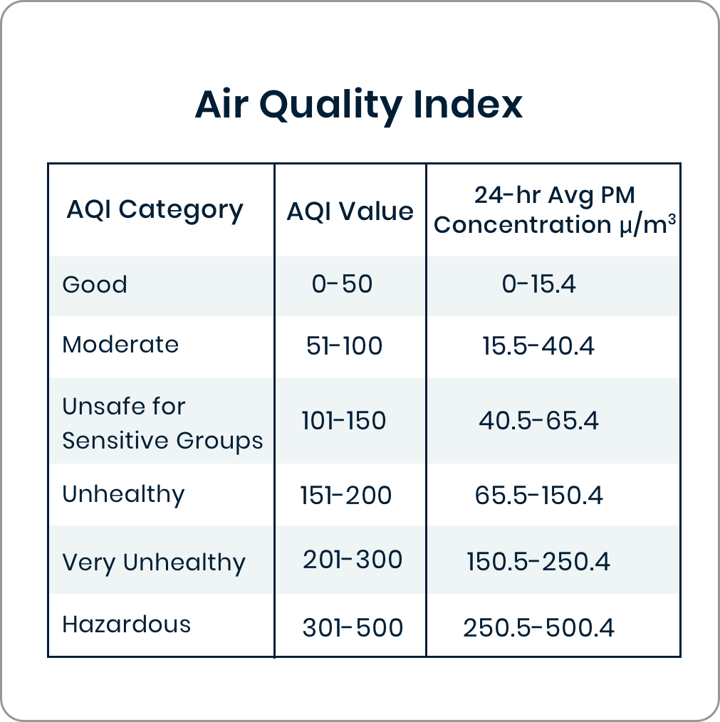
We looked for the areas where air quality (concentrations of PM 2.5) frequently rose above 100 on the Air Quality Index scale, which veers into unhealthy levels, particularly for sensitive groups, such as asthma sufferers. We examined 6802 hourly readings between November 2016 and October 2017.

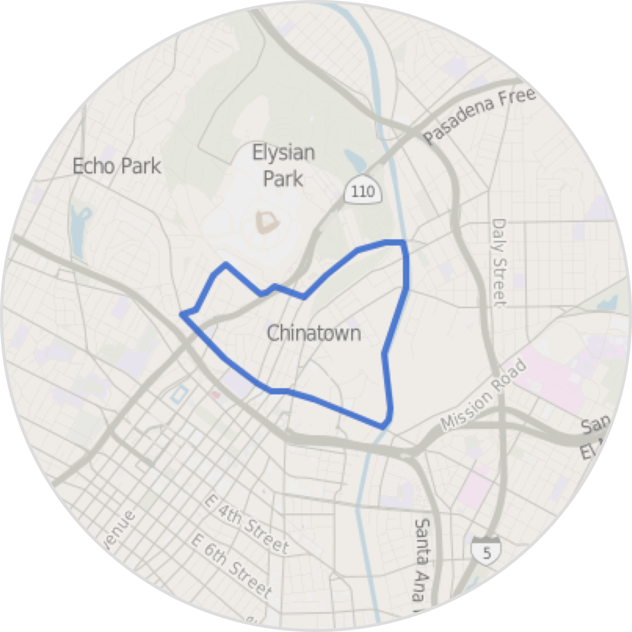
Based on our data, Chinatown had the most hours of unhealthy air.
There were 147 hours that people were exposed to unhealthy air out of the total 6802 hours we observed.

Why?
Chinatown is ringed by three busy freeways in one of the most packed areas of the city.

The average number of hours of unhealthy air for an LA neighborhood is 57.8.
Chinatown had only 2407 hours when the AQI scale was in the healthy zone (a reading below 50), making it last on the list in Los Angeles County.
How We Did It
We collect hourly readings of PM 2.5 levels (particles smaller than 2.5 µm in aerodynamic diameter) from the 12 monitoring stations of the Environmental Protection Agency and the South Coast Air Quality Management District located throughout Los Angeles County. The air quality data is updated every hour. The data we receive is based off of raw PM 2.5 measurements that have been converted to the Air Quality Index scale. PM 2.5 levels are generally proportional to AQI. (However, the actual AQI number is calculated using several different variables and is a 24-hour average.)
continued
We then use a process developed by our partners at the USC Spatial Sciences Institute that takes into account the surrounding geographic context of every neighborhood or area in the entire county of Los Angeles. We use geographic data from OSM (OpenStreetMap) to generate a “geographic abstraction” for each monitoring station automatically. The geographic abstraction is used to describe the neighborhood environment for a given location. For example, we compute the built environment, including the length of various road types, the point number of various locations types, area of open spaces, and so on. Then we build geo-context by selecting important features based on the air quality data.
continued
We create a fishnet of grid points across Los Angeles County. With the geo-context, we are able to compute PM2.5 values for the locations in the fishnet that do not have monitoring stations. We have around 3,000 points in total, four points within one square mile. For each point, we predict an hourly PM 2.5 AQI. We then map that against library of neighborhood boundaries created by The Los Angeles Times.
Have questions? Write us at askus@xtown.la


